
Accurate & Accessible As-Built Information at your Fingertips
Modernize planning, leasing, or renovations with the latest in laser scanning and videography. Get updated plans, models, virtual tours, and aerial footage through our web-based platforms.
Client Benefits & Deliverables


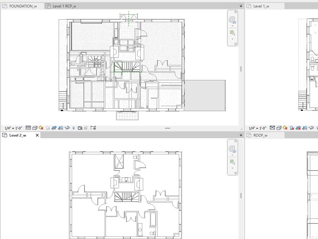
Laser Scanning
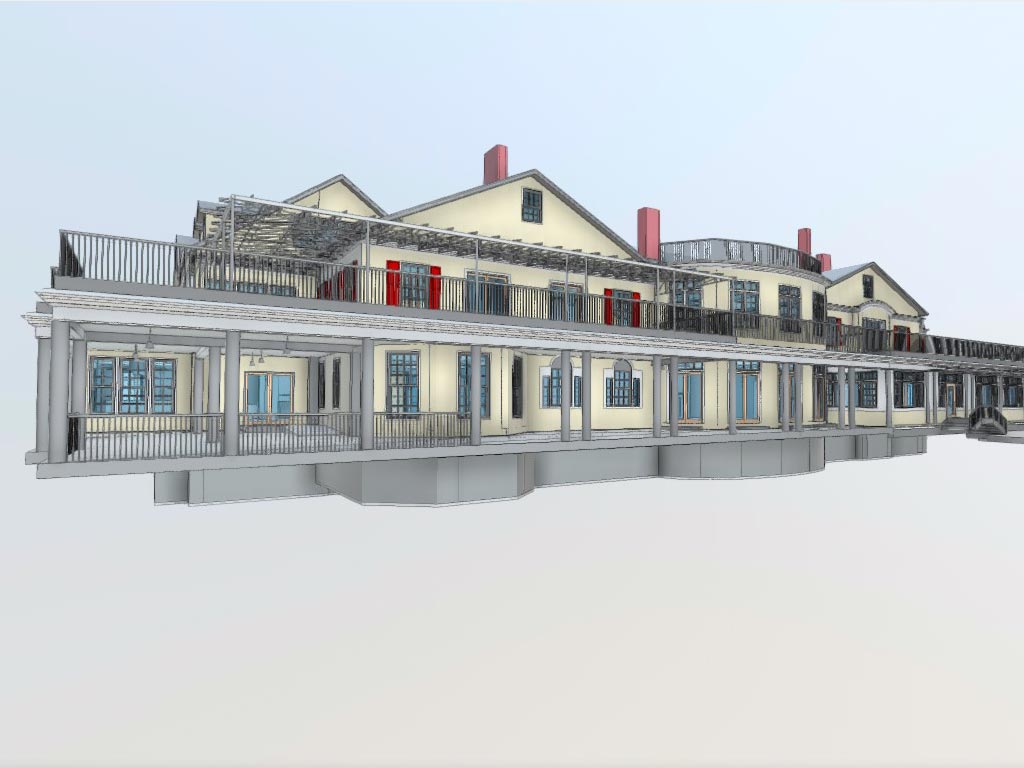
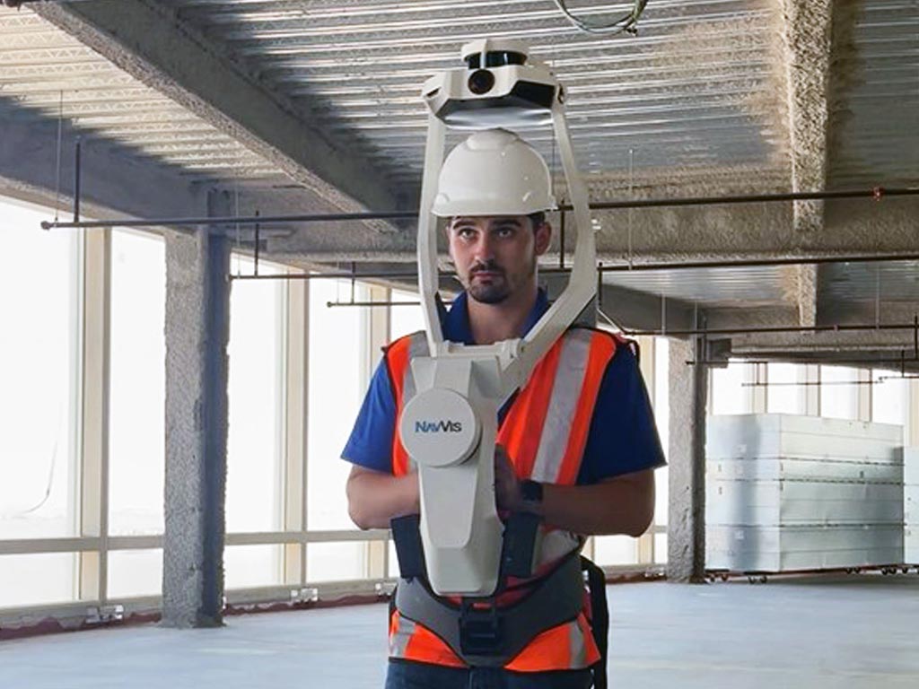
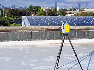
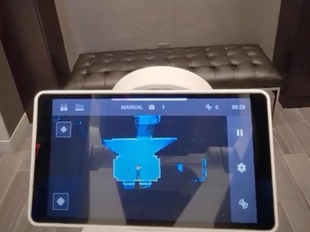
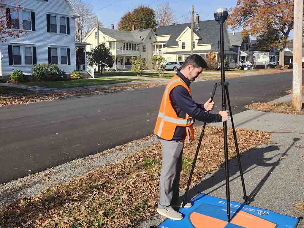
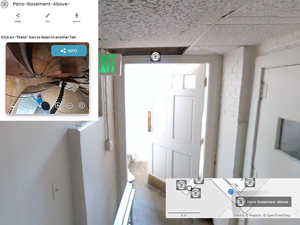
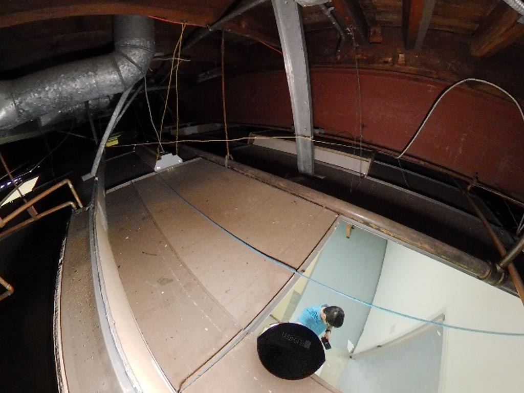
Our wearable Mobile Mapping Scanner captures measurements and 360 Panorama images as we walk through your space. It’s the quickest and most cost-effective way to measure space. When you need maximum precision, our tripod scanner offers the highest level of detail that can be achieved. We can use either or both scanners on your project, giving you the best of both worlds; All the detail you need, reduced time on-site, quick turnaround, and the best price.

Fast
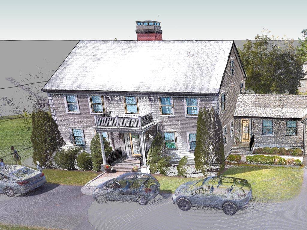
We can scan a room in as little as 15 seconds using LiDAR scanners that capture millions of measurements per second.

Accurate
Millimeter accuracy plus great for hard-to-measure angles, curves, and overhead items. Far more accurate than the measuring tape you are using.

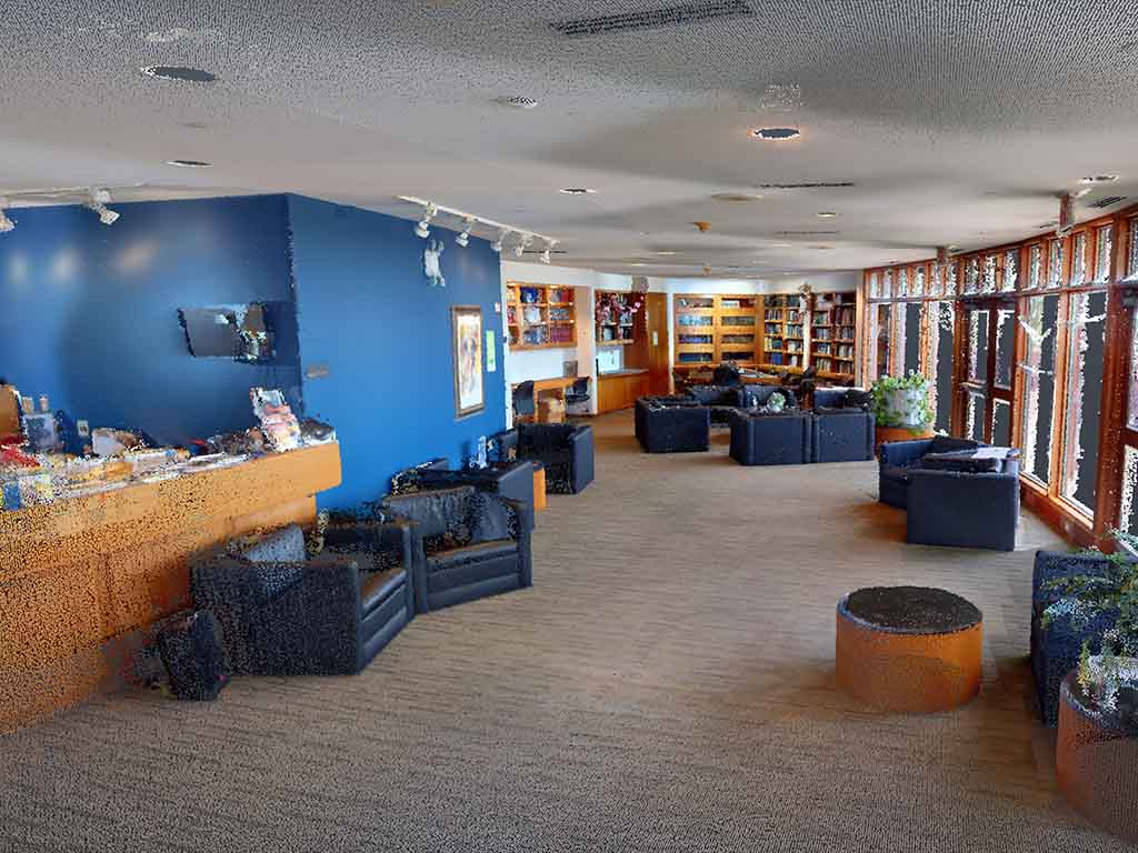
Comprehensive
Scanning captures “EVERYTHING” it sees, including measurements you don’t think you need.

Economical
Laser scanning costs less than you think, and less than if you do it yourself.


Are you ready to elevate your laser scanning?
2 Video Capture Options
Our aerial drone camera captures stunning footage from above, providing an efficient and cost-effective solution for visual documentation. Meanwhile, our mounted video cameras offer on-the-go flexibility, capturing detailed visuals as we navigate through your space. By utilizing one or both camera options, you benefit from the best of both worlds: captivating aerial perspectives, precise on-site footage, reduced time investment, quick delivery, and competitive pricing. Choose our versatile camera solutions for your project and experience the convenience and efficiency they bring.
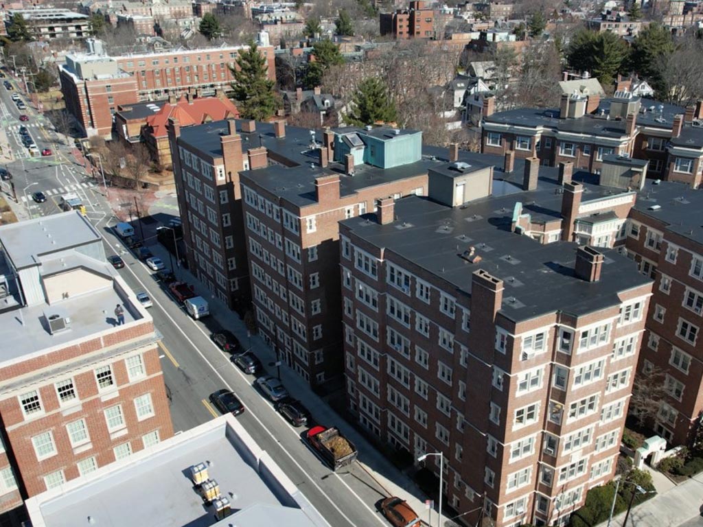
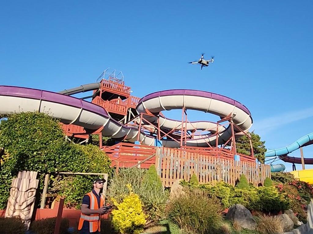
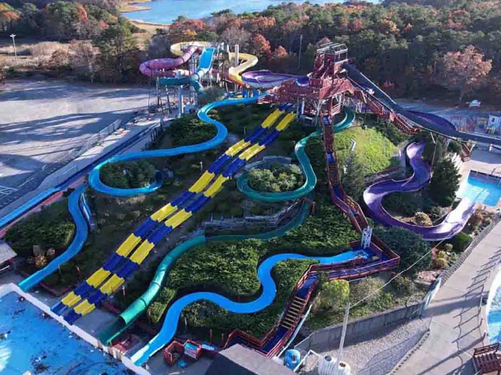
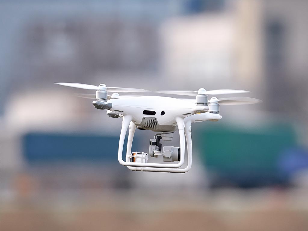
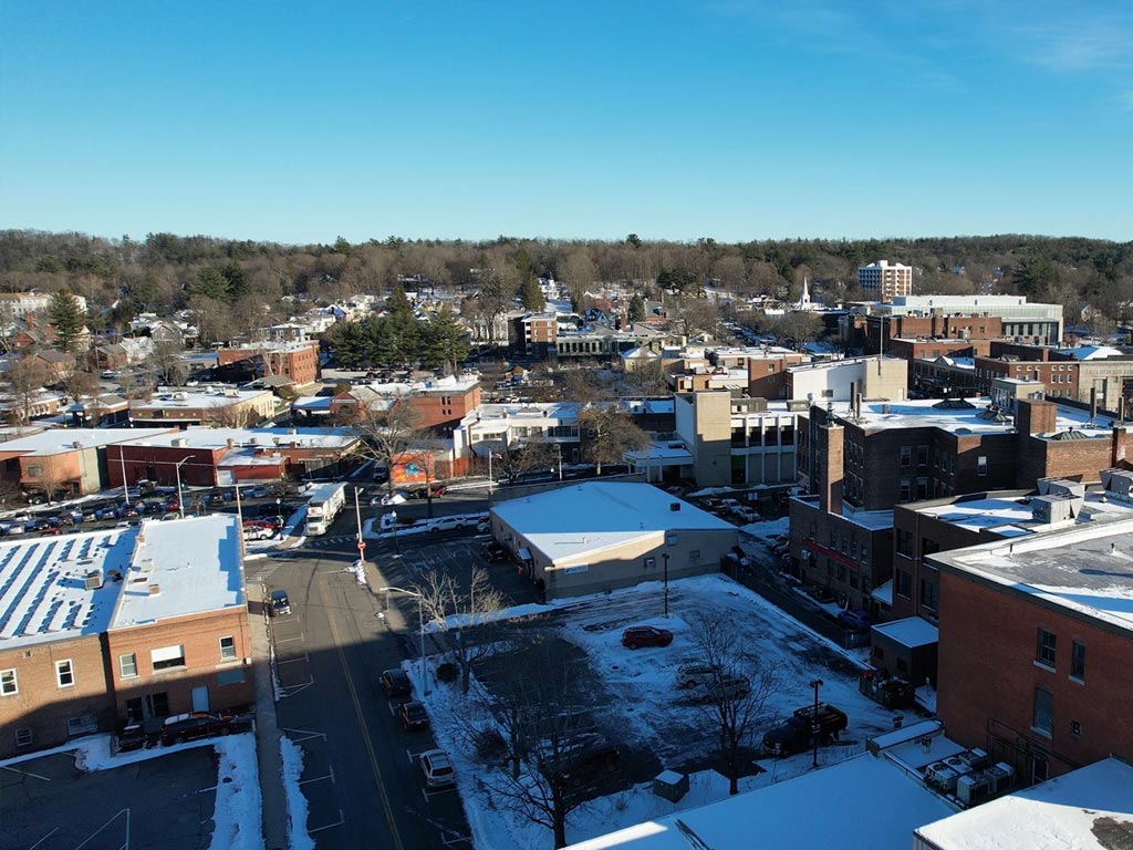
1. Aerial Drone Cameras
Aerial Perspective
Aerial views capture stunning footage that showcases the entire property, its surroundings, and architectural details.
Efficient Surveying
Capturing comprehensive video/images of large or inaccessible areas saves time and resources, enabling prompt inspections, progress monitoring, and detailed documentation for building owners.


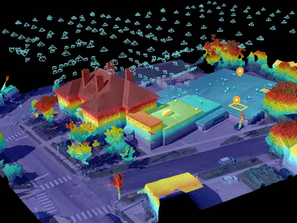
Some of our Drone key features are —Elevations, Contours, and Map Photos. Elevations specify exact height values, providing essential information for accurate mapping and analysis. Contours visually represent terrain shape and slope, giving valuable insights into the topography and shape of the terrain. Map Photos show the distribution of drone imagery for spatial and site inspection.
Whether exploring height data, analyzing contours, or tracking drone positions, we ensure a comprehensive mapping and surveying experience.

Elevations

Contours

Map Photos
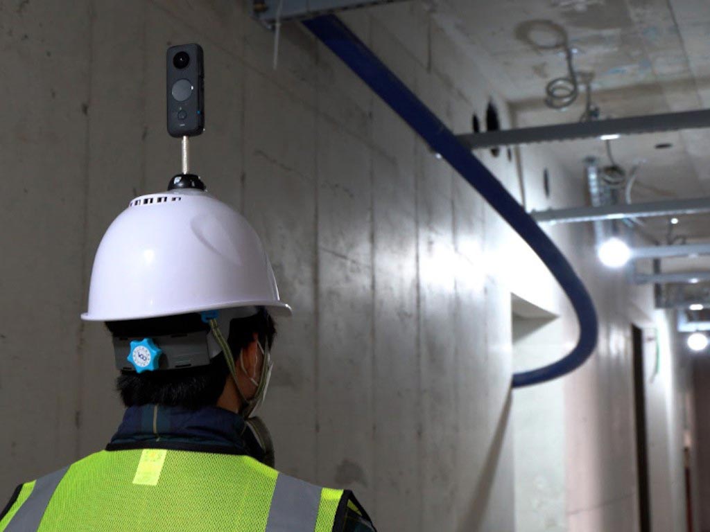
2. Mounted Cameras
Point of View Perspective
Creates a personal connection and enhances the viewer's understanding of the building's layout, points of interest, and spatial characteristics.
Precise Documentation
Mounted cameras ensure stable and accurate footage, capturing detailed video/images, including above-ceiling views, to showcase architectural details, renovations, or property inspections.


Are you ready to elevate your aerial and first person virtual tours?
Our process ensures the lowest cost, quickest turnaround, along with all the details you need!
Project Planning
Discuss what to laser scan or video capture. What to model. What not to model. How much detail.
On-Site Capturing
Flexible scheduling - days, evenings, or weekends.
Assembly
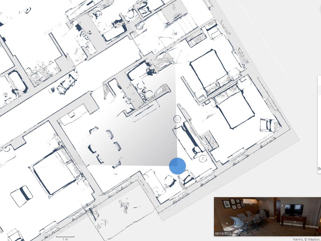
We’ll return to our office and put together point clouds and virtual tours.
Model Planning Kickoff
We build models and virtal walkthroughs the way you want, using your templates, families and standards.
Model Review Approval
Our process ensures that the model and/or virtual tours you get look great, contains EXACTLY what you need, and is USABLE by your team!
